

Our interactive map of Leonida is more than a picture: you can search it, filter it, open a page for any place, and now get GPS-style directions between any two points — with a route drawn on the map and turn-by-turn steps. Here's everything it can do.
The map itself
The base map is the YANIS v16 community map, the most detailed fan-made map of GTA VI's Leonida, built by the mapping community from every trailer, screenshot and preview released so far. You'll see Vice City's streets and districts, highways and their numbers, metro lines, beaches, the Grassrivers wetlands and the Keys.
Use the mouse wheel or pinch to zoom, and drag to move around. Zoom in on Vice City to see individual streets and buildings.
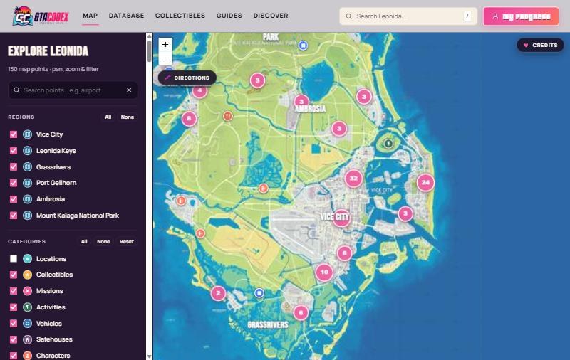
Finding places
The map shows only places that are useful while you play:
- Transport — metro and train stations, bus stops and airfields
- Hotels — possible places to stay
- Gas stations, mod shops, car dealers, gun shops and stores
- Restaurants, bars, nightclubs and clothing stores
- Banks, hospitals, police stations, barbers and tattoo parlours
- Activities such as marinas and golf
Pins group together into numbered circles when zoomed out — zoom in or click a circle to split them up.
- Search: type a name in the search box (for example airport or Xero) to find it.
- Filters: tick or untick Regions and Categories to show just what you need. On a phone, tap the pink Filters button.
- Place pages: click any pin to see its name and type, then Open page → for more detail and a mini map.
Getting directions (GPS)
Need to get from your safehouse to the airport? The map can plan the route for you.
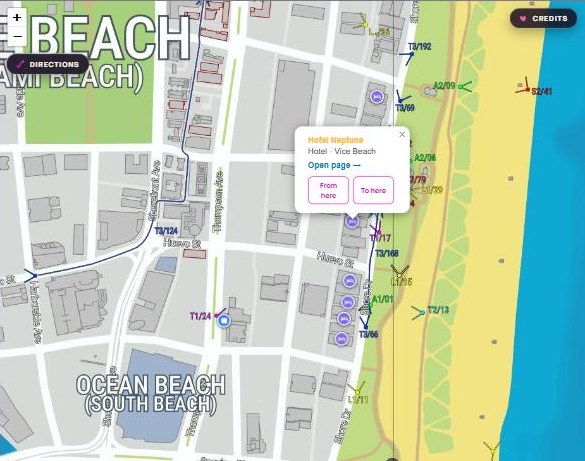
- Open Directions. Click the Directions button under the zoom buttons (top-left of the map).
- Set your start (A). Click anywhere on the map, type a place name in the first box, or click a pin and choose From here.
- Set your destination (B). Click a second spot, type a place in the second box, or use To here in a pin's popup.
- Follow the route. A pink line appears on the roads, with dotted lines for the short walk to and from the road. The panel lists every step, with the total distance and time at the bottom.
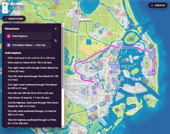
You can fine-tune a route any time:
- Drag the A or B pins to move your start or destination — the route updates instantly.
- Press ⇅ to swap start and destination.
- Clear route removes it and lets you start again.
- Copy link gives you a link to that exact route to send to a friend — for example Vice Beach to the airport metro.
Reading the steps
Steps read like a satnav:
- Drive west on Huevo St for 155 m
- Turn left onto SW 4th St for 575 m
- Take Route 10 west for 1.1 km
- Turn right, head north through Ocean Beach for 1 km
Street and highway names come straight from the labels printed on the community map. Where a street has no label, the step tells you which district you're driving through instead.
How the route is chosen
Directions look for the fastest route, not just the shortest:
- Highways count as much faster than city streets, so a longer drive on the highway often beats cutting through town.
- Turns cost time. Turning left (across traffic) costs more than turning right, and U-turns cost the most, so routes avoid zig-zagging through blocks.
- If you click somewhere off-road, the route starts with a short walk to the nearest road.
On your phone
Everything works on mobile. The Directions panel slides up from the bottom so you can still see the route above it, and the Filters button hides while it's open. Tap the × to close it.
Good to know
- GTA VI isn't out yet, so the map — and therefore every route — is based on the community's best reconstruction from official footage. Some roads may change at launch.
- Distances and times are estimates. One-way streets aren't known yet.
- Only streets with a printed label have a name; others show their district.
- A few small islands don't yet have a known bridge on the map, so a route there starts or ends at the nearest connected road (the panel tells you when this happens).
We'll keep updating the map and the road network as new footage and the game itself arrive.
Credits
The base map and much of the location data come from the gtadb.org YANIS v16 community map by gtadb.org and all contributors, under CC BY 4.0. The road network and street names used for Directions were traced from that map by GTA Codex. Places are curated by the GTA Codex community.
Related: the world of Leonida explained · GTA 6 Vice City: everything we know · open the map.